The Geodel Platform
A hydrological intelligence platform for critical mineral operations. Geodel connects hydrological monitoring, operational analytics, and predictive intelligence into a unified platform designed for modern mineral infrastructure.
Real-Time Resource Monitoring
Geodel integrates operational and hydrological data across mining systems in real time. We build the connection between sensor arrays and operational decision points.
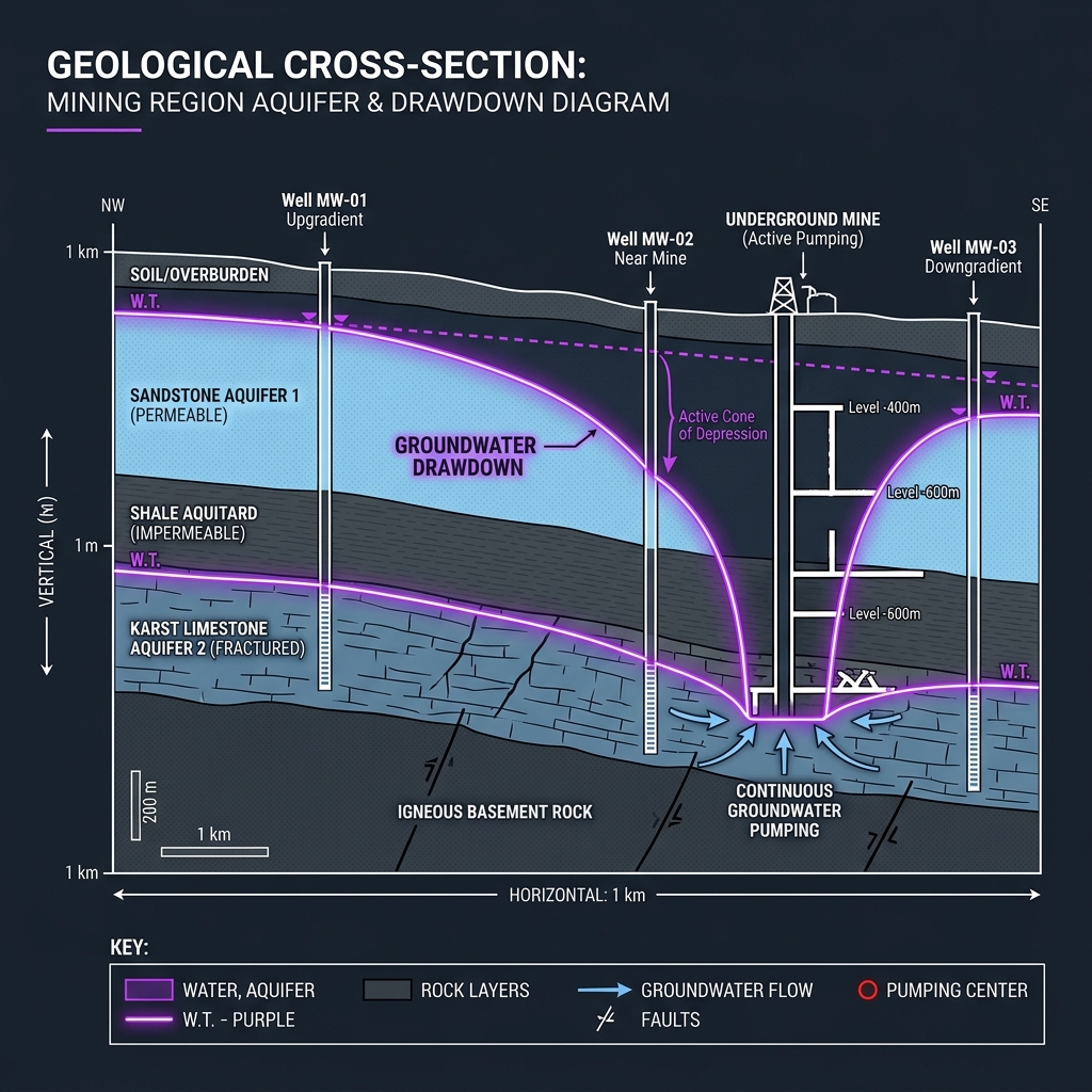
Groundwater Sensors
Telemetry tracking aquifer levels and conditions.
Flow Monitoring
Continuous pipeline and open-channel flow rates.
Water Quality Instrumentation
Chemical profiling, pH, and sediment indicators.
Telemetry Infrastructure
Remote edge-transmission systems.
Tailings Inputs
Geomechanical and hydro-pressure sensors.
Climate & Environmental Data
Weather patterns and watershed context.
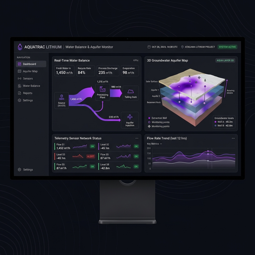
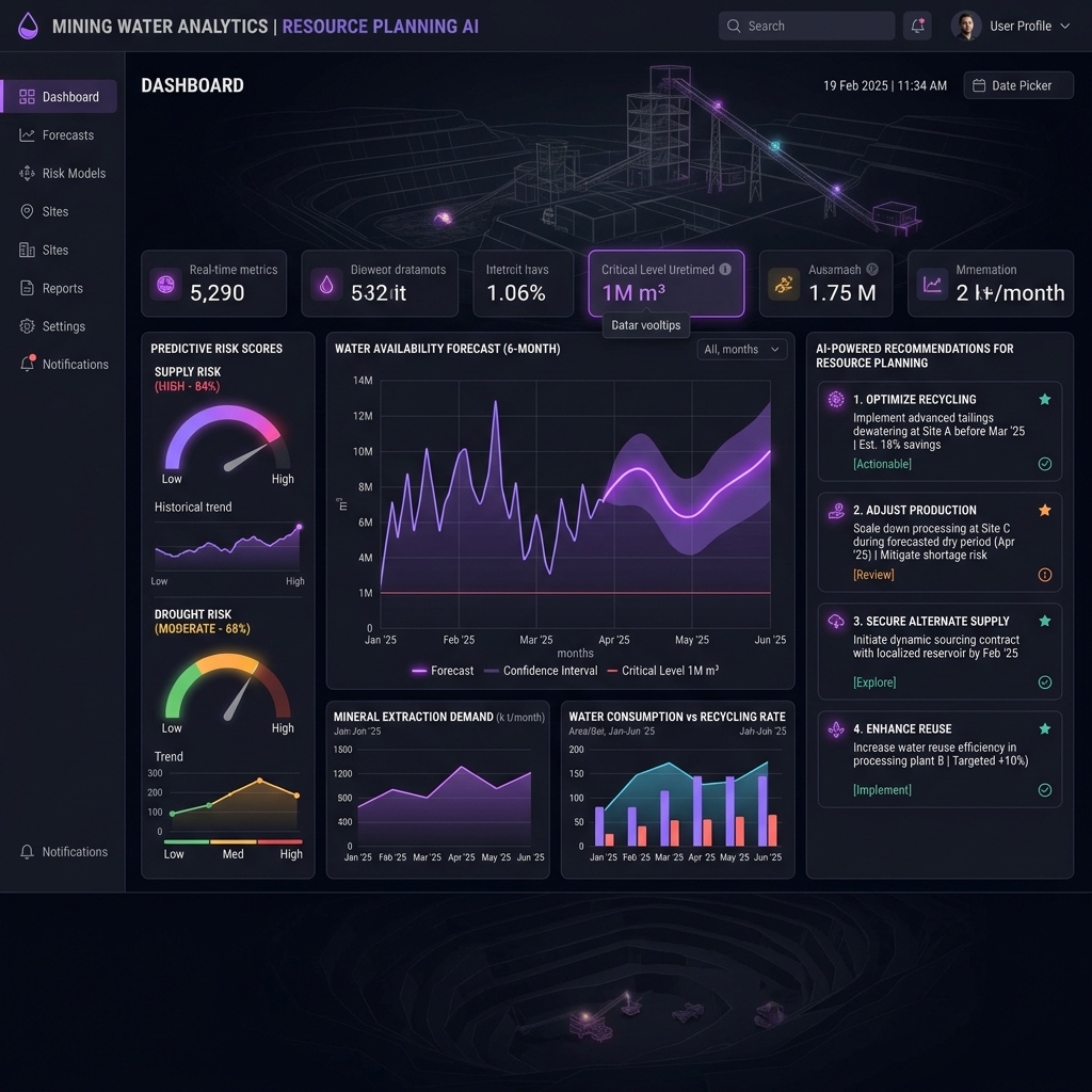
Predictive Hydrological Analytics
Geodel’s intelligence engine continuously processes historical trends, sensor streams, and mechanical variables.
Actionable Operational Visibility
The platform delivers clear, real-time insights designed for engineers, hydrologists, and site managers.
Live visualization of active fluid flow systems.
Notifications when thresholds approach critical risk values.
Scenario models predicting water availability.
Tracking usage, recycle rates, and losses.
Built for Critical Mineral Infrastructure
Flexible and resilient deployment modes to support remote mining sites.
Cloud Deployments
Centralized databases, aggregate metrics, and cross-site trends.
Edge Monitoring
Local compute hardware operating without consistent internet connections.
Remote Integration
Interfaces seamlessly with telemetry and legacySCADA systems.
Scalable Infrastructure
Designed to expand as your extraction footprint and monitoring nodes grow.
Experience the Geodel Platform
See how Geodel can transform water balance and risk forecasting at your critical mineral operations.
Schedule a System Demo →